Trip distance and Time trip correct at Peru/Bolivia border 11/08/11
More photos in the Peru 2011 gallery
The motorcyclists amongst you may also like the
‘Trails of South America…a photo journal’ gallery which supports my ADV Rider thread
Peru
When I first properly looked at the map of Peru I was immediately struck by the potential to traverse it along the Andes, primarily on dirt roads. Despite a government TV advert claiming 10k km of new roads had been built (or should that be ‘surfaced’?) I still rode 3193km of dirt; almost 50% of my total distance in the country. The graph below shows how much of that time was in the mountains.
GPS profile of Peru 2011 route
Continued from Chapter 26… I hadn’t realized he (the Migracion Officer) was still in bed of course until someone spotted me waiting outside the ‘Migracion’ office and directed me to the yellow building with the red roof. A guy who later turned out to be the immigration officer leaned out of an upstairs window and said he’d come down. He let me in, filled in a form and sent me to the Police building on the low ground adjacent to the bridge. I’m not really sure what their part of the process really achieved as all they seemed to do was read my passport, stamp the back of the form I’d taken to them and get sent to the ‘Migracion’ office where I’d started. By the time I got there the guy from the yellow building was sat behind the desk in his uniform and stamped my passport. Getting Rosie’s temporary import permit took a little more time thanks to a poor internet connection but it was a friendly process and I even got given my own chair in front of the computer, next to the customs officer so I could help him complete the online permit. When he sent me to the local shop for a photocopy of my Registration document there was a problem with the photocopier and the lady ran the first copy through the machine 10+ times, overprinting the same image until it became dark enough to read!
When I eventually walked outside with all my paperwork it was of course raining. I’d read on the HUBB about a couple of guys who’d taken 3hrs to ride to San Ignacio in the rain because of the mud. Luckily for me it didn’t get too muddy and an hour later I was in San Ignacio. I rejoined tarmac exactly 100km south of the border and topped up with gas so I could get some change for the big notes I’d been given in the ‘Cambio’ in Cuenca and rode away doing the sums in my head to work of the price of gas. Had I really just paid 92p/ltr (U$5.80/gal)? I had. Peru was going to be expensive.
I got my first taste of Peruvian sunshine as I rode through a gorge heading for Pedro Ruiz so I stopped at the roadside to brew coffee, take a few photo’s and soak up the view. There’s always something special about entering a new country (even one you’ve visited before) and it’s good to take a break and acknowledge those first few differences.

Sunshine at last on the road to Pedro Ruiz
I’d hoped to ride to Chachopoyas that afternoon but it was getting late and according to my map it was a dirt road beyond Pedro Ruiz so I spent the night there. I needn’t have tough as the road turned out to be tarmac all the way and it took me all of 45mins to ride to Chachopoyas. I had a ride around town, bought some supplies for camping, filled up with gas and rode out of town. At the turn off onto the dirt road to Celedin I descended into the valley and found a quiet, secluded spot by the river and set about making breakfast. I rejoined the main track just as it started drizzling and rode south to the turn-off to pre-Inca ruins of Kuelap. Thanks to an email from Frank & Simone I knew I could camp at the ruins so I had a leisurely wander around and bumped into a tour group containing Mark & Claire!
We could only manage a brief chat as their tour had a lunch booking. I did learn though that their reason for not coming on the bikes was that Mark had blown a fork seal and wanted to avoid what they expected to be a rough ride to the ruins. Had they known it was as smooth a dirt road as it was they would have ridden.
Whilst the ruins themselves were reasonably impressive that must have made for an incredible sight in their heyday. Built over a period of 200years from AD900-1100, the site originally contained three times more stone than the Great Pyramid of Giza!

Kuelap Ruins
Back at the snack kiosk next to the ticket office I asked the lady about big bottles of water. Stupidly I’d forgotten to fill up in Pedro Ruiz and now I had none to cook with. She only had small bottles but when I told her I wanted it for cooking, not drinking, she glanced down at her own 4ltr container and said I could have the water so long as I returned the container in the morning. As the sun set so the 4×4’s loaded with supplies for the mule trains disappeared one-by-one and eventually the mule trains themselves wandered off into the darkness to supply the communities dotted amongst the hills leaving me with two grazing horses for company.
I awoke early to a blue sky but before the sun reached my side of the valley so it clouded over meaning it took a long time for my tent to dry out. It was an hour’s ride back to the main track in the valley but by then the clouds had started to break up.

Chachapoyas - Celedin road
The track was in excellent condition and followed the river through the valley to Leimebamba where it began its climb out of the valley to the Abra Barro Negro pass at 3600m.

Looking west across the Marañon Valley
The views across the Rio Marañon from the pass were spectacular and continued to be so along the 60km descent (2.7 vertical km’s!) to the river at Balsas. It was such a beautiful spot I had to find a bush camp. From the east bank of the river I’d seen a potential spot but when I got there I was undecided as to whether or not it belonged to the adjacent property. There was nobody home and so I hung around for 45mins in the hope somebody would turn-up. They didn’t. I rode on along the riverside and climbed the first switchback for a better view in the hope of spotting a campsite. Just as I finished taking a few photos, who should ride around the corner but Mark & Claire! When I told them what I was doing Claire was immediately into the idea and the pair of them waited whilst I scouted out a goat trail down below. Unfortunately it led to a deep washout that we wouldn’t be able to cross so we decided to take a look back on the east bank along the road to Bolivar.

Rio Marañon near Balsas
It wasn’t long before we came across two guys building a house and asked them if we could camp on their land. I think they were too shocked at our request to say know and once we’d confirmed it was only to be for one night they said yes and we were soon sitting outside our tents with a brew.

Making camp near Balsas with Mark & Claire
It was bloody hot in direct sunlight down in the valley and so I got up early and had Rosie packed before the sun struck our campsite. I left Mark & Claire and began the long climb out of the valley and over a pass to the market town of Celedin. It was Sunday, market day and the streets were filled with indigenous folk from the surrounding villages busy buying and selling sheep and cattle. The region had its own style of hat that was obviously such a trademark that the shelter in the plaza had been built in its honor.

Celedin Sunday market

'Hat Plaza', Celedin
The scenery changed dramatically after Celedin. The steep sides of the river valley replaced by the plateau of divided farmland. Across one more pass and I rejoined tarmac on the descent into Cajamarca. I found a field outside an army training college and pulled in to make some lunch. At first I thought the college was empty but as I unpacked my stove so I saw the inspection hole in the main gate open. I wandered over to check it was ok for me to be there and the request was shouted up the ranks until the senior officer came out for a chat. When he saw I was about to make sandwiches he sent his subordinate to the kitchen to fetch me a bowl of chicken, rice & platano (a not so sweet banana usually served fried).
I rode around Cajamarca for what seemed like ages trying to find a cheap place to stay with safe parking for Rosie. I eventually came across ‘Las Tajas’, just off the main plaza and as I was checking in who should arrive but Mark & Claire.
Great company as always we wasted no time in taking full advantage of Cajamarma’s place at the centre of northern Peru’s dairy production and soon acquired a whole fresh cheese from the market along with a bottle of red, fresh bread and a bag of olives, etc… Too expensive to do alone but a bargain when divided by three!

Claire put together a great feast
I really liked Cajamarca. A typically picturesque South American Plaza de Armas (Central Plaza) surrounded by a Cathedral, Bishops Palace and a convent, all with elaborately carved facade’s and beautifully lit at night. Cajamarca is also the location of the first showdown between the Spanish Conquistadors and the Inca’s (1532). Pizzaro ambushed Atahualpa who, realizing he was bargaining for his life reached up and drew a line on the wall saying he would have the room filled to the line with gold and twice with silver. After striking a deal the Spanish promptly betrayed and ultimately executed Atahualpa.

Cajamarca Cathedral
I slept poorly thanks to all my sand fly bites (a theme that was to continue for several nights) and spent the following morning on a wild goose chase looking for kerosene to clean my chain. (It wasn’t until I left filled up with gas in Huaraz ten days later that I finally learnt that kerosene is banned in Peru because of its use in cocaine production).
After three nights in Cajamarca I said goodbye to Mark & Claire who were heading for the coast, and set off SE through Cajabamba and Huamachuco to pick up a dirt road atop a high pass. It was a rough road under sullen skies that led me to the nondescript mining settlement of Angasmarca where I eventually found a place to stay full of miners.

Belen Hotel, Angasmarca
(ROUTE INFO: It is virtually impossible to trace my route on paper maps as many of the settlements aren’t shown so for those searching for route ideas through Peru this was my route from Cajamarca to Huaraz: Cajabamba – Huamachuco – Angasmarca – Mollebamba – Mollepata – Pallasca – Huacaschuque – Huandoval – Cabana – then back onto tarmac through Tauca – Ancos – Chuquicara – east into Canyon to bush camp then backtrack to just NE of Ancos where I picked up the dirt road through Santa Rosa – Llapo (detour) – Conamires – Bambas – Yupan – La Pampa – SW to Rio Santa Valley – Yuracmarca – Huallanca (Canyon del Pato) – Huaraz. NB: Because of all the stops for photos and my detour via Llapo it took me 3days/2 nights).
Thanks to the guy and his radio in the next room I was awake at 0530 the next morning so I got up soon after, made breakfast and was riding by 0650. It was drizzling as I rode south towards Mollebamba, Mollepata and the valley at Tablachacha so I virtually ignored the scenery and enjoyed riding the often sandy deep ruts that had been worn into banked turns and I had to keep telling myself to “slow down!”

Mollebamba

Mud bricks laid out to dry in Mollepata

Overlooking Tablachacha

The descent from Mollepata to Tablachacha
The road continued to Pallasca where I managed to arrive on the ‘day off’ in the middle of a three day festival (June 21, 22 & 24!!!) in honor of St. John the Baptist. Stalls were still set up and the band was playing so I’m not really sure of the reasoning behind the festival skipping the 23rd.

Pallasca
I stopped in the plaza, wandered around, had a drink, took a few photos and chatted with the soldiers stationed on the plaza. When I asked the way out of town I was amazed that my request for directions had to pass through three soldiers before one could be found who knew the answer! Had all the recruits been taken to Pallasca under cover of darkness and forbidden to leave the plaza during daylight hours?
After a few more hours on the dirt I rejoined tarmac and was immediately afforded a fabulous view across a wide east/west valley.

View from the Cabana - Ancos road

Panoramic
As I rode west and began my descent towards the Rio Tablachaca the formations of the valley walls reminded me of Ladakh, India.

Riding from Cabana towards the Rio Tablachacha
I passed an abandoned mining village that appeared to have been the victim of a landslide and had since been stripped of all its usable materials.

Abandonned village
At the head of foot of the valley a series of switchbacks carried me down to the Rio Huaychaca where the road turned south and led me through a narrow gorge. The river was full of boulders of an incredible size, all worn smooth from tens of thousands of years of water erosion. Once across the Rio Santa at Chuquicara a dirt road led east towards Cañon del Pato. Thanks to Frank & Simon (2x Honda Transalps – Chapter 23) I had a link to a waypoint for a bush camp 15km or so along this road.

Sheltering from the wind prior to pitching camp
Despite its initial unappealing location it was actually possible to pitch camp out of sight of the road. I made a windbreak using Rosie and my tarp and with a cup of tea in hand I reflected on the fact that the only other vehicles I’d seen all day had been in Pallasca. Just my kind of route, and with that thought in mind I pitched my tent.
The following morning I backtracked to Ancos in search of the dirt road that would lead through Santa Rosa. The track on my GPS was clearly wrong and it took a bit of asking around until I found where I was looking for (blatantly obvious if you knew where to look but it didn’t exist at all on my paper map and my GPS map was wrong). Once on the right track I climbed through El Porvenir and Santa Rosa and past another dirt road that branched off into the next valley. That would wait though as I wanted to visit what I’d read was the ‘friendly village of Llapo’. It turned out to be an apt description.
Llapo is very old and very quiet. As I rode into the sleepy plaza I was the only thing producing either sound or motion and so felt even more conspicuous than usual. I stopped at a small shop on the plaza to ask where I could get a coffee only to find it empty. A woman appeared, running across the plaza apologizing profusely for not being in attendance but had no idea where I could find coffee. She shouted across to two old guys sitting on a bench on the plaza and so began a cross street discussion until a third guy appeared and said he knew but needed to check. He walked to the corner of the plaza then disappeared before re-appearing a few minutes later and gesticulating for me to follow. I parked Rosie and followed him through a door into what I was expecting to be a café/shop only to find myself in the livingroom of 71yr old Ricardo.

Ricardo was a great host and guide
Ricardo took great pride in telling me that he still played football and demonstrated his athletic prowess by kicking his feet to shoulder height!
He made coffee, produced a large chunk of cheese and some bread rolls and we chatted about his house and family. He had nine children, five of which are merchant seamen aboard ships all over the world. The house was 120yrs old and the wallpaper in the background of the photo of Ricardo is the original!
As I finished eating so Ricardo said “Me casa es su casa” (“My house is your house” A particularly friendly Latin American greeting) and went on to say that as such, there would be no charge for the food or coffee.
I took a walk around the village and it wasn’t long before Ricardo appeared at my side. He led me through the back alleys where we met a few more locals who, to my surprise, were happy to have their photos taken despite one of them exclaiming that her pinafore was dirty and that she hadn’t washed her hair! She was in luck though as my camera battery expired after two shots and my spares were on my bike…DOH!

Llapo Village
Ricardo found the church caretaker and had the place opened up so that I could look inside and climb the bell tower for a view across the village. The building next to the church was the only one on the plaza that had a tin roof instead of the traditional tiles. Ricardo explained that in 1997 an earthquake had toppled the upper half of the bell tower and it had fallen through the roof of the next building. Luckily it was empty at the time!

Llapo Village
Ricardo had been a fabulous host and guide and as I prepared to leave so he presented me with a bag of apples “Por el camino” (For the road). What a guy.
As I rode away from Llapo back to junction with the track to the next valley I took a few photos of the road to Llapo.

Road to Llapo
(Route note: Paper maps show only one way in/out of Llapo – from the south. However, the road does continue north to Tauca)
Back at the turn-off I’d noted en-route to Llapo I turned east and climbed over the pass to the next valley. From the pass what appeared to be an endless landscape of deep valleys stretched all the way to the horizon.

The road to La Pampa
It was far more arid here than in the previous valley and I was soon riding in shallow sand amongst the cacti as I descended towards small village of Conamires. The route out wasn’t obvious and so once again I stopped to ask for directions and as I did so the local kids gathered to check me out.

Like most villages I was a novelty in Conamires
From Conamires the track narrowed and the tyre tracks disappeared, only to be replaced by footprints and animal tracks. Staying high on the valley wall the track wound its way through Bambas before climbing again. Before crossing the next pass I took a few photos looking back at Conamires.

Conamires seen from the road above Bambas

Conamires close-up
From the 3400m pass above Bambas in one valley and Yupan in the next I was afforded my first view of the snowcapped Cordillera Blanca rising above 6000m some 35km away to the SE.

My first view of the Cordillera Blanca
It was a long descent through Yuan and on to La Pampa. Approaching Yupan I came across a gang of drunken road gang swinging pick axes as they dug a trench across the road. They wanted some money for more liquor in return for placing some planks across the trench so I could pass. There’s no negotiating with a drunkard, let alone five and so once across I gave them a few soles and took their photo.

Drunk road gang near Yupan

Approaching Yupan
Once in La Pampa I stopped at a restaurant to ask the whereabouts of the gas station only to be told there wasn’t one. The owner of the house opposite was quickly summonsed and sold me a gallon of gas and gave me directions to the hotel. 20 soles (U$7.50/£4.50) bought me an en-suite room and secure parking for Rosie. Back at the restaurant the owner who looked to be late 30’s turned out to be 24 and the girl I took to be here daughter was her 13yr old deaf/mute sister. They had their own way of communicating and after watching them interact whilst awaiting my food I had a long conversation with the younger one. Her sign language included squeezing one breast to indicate ‘mother’.
I made another early start the following day and was riding by 0715. The track led out of town into a barren but multi-coloured valley of red and black and tan rocks. Much of the Rio Santa valley was still in darkness when I arrived and so I found a decent overlook, pulled off the road and made breakfast. Once the sun had reached the valley floor I set off to join it.

Rio Santa valley
This was the valley in which I’d camped two nights previously. My actual campsite was just 32km west of where I rejoined the valley from La Pampa.

Rio Santa valley near Yuracmarca
The river brought life to the valley until it became so narrow that there was no room left for anything but water. There at the village of Huallanca a huge hydro-electric station had been built and the road climbs above the river in a series of switchbacks before commencing its journey through 30+ tunnels hewn out of bare rock way above the now trickling river. (It must have been one hell of a sight before being dammed).

Cañón del Pato
Huaraz
In the California Cafe in Huaraz I met fellow Englishman Charles Saxty Good, owner of Llanganuco Mountain Lodge on Lago Keushu nr Yungay. As well as a website to promote his own lodge he has been working on a second to promote all the lodges in the region. However, he had no information regarding Chacas and offered me a free nights camping at his lodge in return for gathering whatever information I could regarding accommodation there. I was going there anyway so it was a fair deal.
I headed north out of Huaraz and cruised up to Carhuaz out the back of which a dirt road led into the mountains. I’d not ridden far when I got stopped due to road construction and began what was to become the first of many stops totaling 3.5hrs that day. When the road was finally opened I didn’t ride far before meeting Dutch cyclists Maarten & Karen(?). Unlike many cyclists (but not all) who ride across countries in fairly straight lines, this couple rode loops, detours and the roads less traveled (it had taken them 2 yrs to get here from Alaska).

Maarten & Karen(?) from The Netherlands
Another 20mins up the road and I was told I’d have to wait 1h20 for the road to be opened so I found some shade, unpacked my stoke, brewed fresh coffee and made PBJB’s for lunch. Of course just as I was tucking in a whistle blew and I was waved at to move on…ggrrrr….
Three switchbacks later and I was stopped again, their lack of communication between traffic signalers was beginning to grate.
Finally I rode through a narrow gorge and into a glacial valley at 3800m for my first view of the Cordillera Blanca…

Carhuaz to Chacas road
At the head of the valley I was stopped again just before the switchbacks began but fortunately not for long and I was soon climbing towards the pass with a beautiful view of the Quebrada Ulta.

Quebrada Ulta, Cordillera Blanca
By the time I’d crossed the pass the sun was setting. The flat of the valley below looked like a good place to camp but getting there was a different matter. By the time I’d descended far enough to access the flatland it was virtually dark and so with no obvious track to the flatland I opted to ride on to Chacas. I rode the last 40mins or so in the dark, doing my best to escape the dust of the trucks and buses. There were only two places in town with signs advertising accommodation which made my research for Charles easy but didn’t give me many options. Both were full with construction workers and would be for the next year, so I was told. I was led down a dirt road and told to wait by a wooden gate which, after a few minutes opened to reveal a drop of 6-8′ over some steep, rough stone steps and into a garden. Getting in would be ok but what about getting out in the morning? Luckily there was another door at the end of a short corridor that led into another street. Unloaded it looked doable so I rolled Rosie down the steps and into the garden of the house that had a few unadvertised rooms to let.
In the morning I took a look around the town, admiring the Italian wood carving.

Beaufully carved church door in Chacas

Chacas
My route west back across the Cordilera first took me to north Yanama via Sapcha before turning west towards Yungay. A steady climb on reasonable roads took me past a series of lakes en-route to the summit.

High pass on the Yanama - Yungay road
These switchbacks lead down past Lagunas Orconcocha, Llanganuco and Chinancocha. A little further on there was a cracking viewpoint looking straight down the valley over the Lagunas but as you can see from the next photo (shot into the sun) I was about 2hrs too late and the lakes were in the shade…shame.

Descent to LagunasOroncocha, Llanganuco & Chinancocha
There was a cold wind blowing along the valley and with no sun it got surprisingly cold. I was glad to emerge into the open and take the side track to Lago Keushu and the Llanganuco Mountain Lodge where I found Charles and a proper mug of proper English tea.
I soon had my tent pitched below the peak of Nevado Huandoy (6395m/20,981ft) and after cooking a huge bowl of pasta I joined Charles in the bar/restaurant with English couple Simon & Lea who I’d met in a cafe in Cuenca, Ecuador and again in the California Cafe in Huaraz. A great end to a great day.

In the shadow of Nevado Huandoy at Llanganuco Mountain Lodge
It was a short ride back to the main north/south road the following morning and once on it I headed back to Huaraz. After a quick stop for fuel I continued the gentle climb south towards Catac, the valley narrowing and becoming prettier as it did. In Catac I turned east to cross the Cordillera Blanca for the third and final time.

Catac - Chavin road, Cordillera Blanca
Lunchtime was approaching and Laguna Queroccocha seemed like a nice spot to stop.
From the main road a track led across a shallow(!!!) river to some flat ground where I decided was a good spot. The river looked no more than 10″ deep as I approached but what I couldn’t see was the deep channel running through the middle. I rode in slowly but as my front wheel disappeared and the water came over my boots I gassed her up and made it through without drama – except that now I was wet almost to the crotch and I had a 4500m pass to cross – not one of my better ideas!
I dried out pretty quickly in the sun as I ate lunch but of course I still had to re-cross the river to get back to the road.

LagunaQueroccocha
After a night in Chavin on the east side of the mountains I rode north a little way to SanMarcos where I picked up a dirt road heading east through two mines and crossing two passes at 4500m+; the first of which would have been spectacular had it not been for the low cloud. I descended and climbed again, this time into the cloud and rain. I stopped at a couple of sentry posts to check I was going the right way – I was. The second pass took me parallel to the spoil site of the Antamina mine. I took a few shots with my pocket camera just for memory.

Antamina Mine spoil. The bulldozer gives a sense of scale
I climbed and climbed, getting colder and wetter, cursing my broken heated grips. The next descent took me to a checkpoint from where the road through the mine was only open every other hour. I got lucky and after a chat with the security guard (who told me the previous day had been blue sky and sunshine!) he let me through. I rode across huge rocks that had been compacted to build what I later realized was a dam. The scale was so big I couldn’t appreciate where or what I was riding on until I eventually got to look back from a distance. When I did get to see ‘the big picture’ I realized that all the silt being pumped into the lake had raised the water level to the extent that the lakeside road vanished into the water in several places and that therefore an enormous project was underway to contain the lake. Had it not been pissing down I’d have taken some photos.
A bit of info regarding the mine: “The deposit is one of the largest copper-zinc ore bodies in the world. The US$2.2 billion construction program was one of the largest new mine development projects ever undertaken. In order to reach the mineral deposits, tops of several mountains had to be removed and a lagoon drained. It took four years of work.” – http://www.infomine.com/minesite/min…?site=antamina
On the far side of the lake I passed the massive accommodation blocks and rejoined tarmac before climbing back to 4500m. Given the weather I was tempted to stay on tarmac all the way to Huallanca but my Cordillera Blanca map showed a dirt road ‘short-cut’ and with the sky ahead black as the ace of spades I decided I liked the idea of the short-cut alongside the Rio Andachupa.

Heading into the Rio Andachupa valley
Life hasn’t changed in this valley for years. The narrow river snaked in perfect ‘S’ shapes along the impossibly green, perfectly flat valley floor. There wasn’t a car or satellite dish in sight, tiny stone built houses with thatched roofs were arranged in U shapes with a livestock shed and blackened cookhouse.
The track eventually intersected with the Huallanca – La Union road and I turned east once again and rode through La Union and on to Huanaco. It was a typically beautiful ride through narrow gorges that led to another climb back into the cloud and yet more rain as it ran alongside a rocky outcrop that resembled a crown. The descent into the next valley would have been yet another beauty but for the cloud and failing light.
It was well after dark when I rolled in Huanaco and began riding ‘laps’ of the city in search of cheap accommodation with secure parking. Eventually I gave up and rode south out of the city in the hope of finding something on the outskirts. I got lucky and checked into Tito’s where Rosie was safely locked away whilst I wandered down the street for chicken ‘n’ chips.
Cold…f#@* cold!
Up at 0600, riding at 0620 and wearing waterproofs by 0645. It was a cold, wet ride that became progressively colder as I approached Cerro de Pasco at 4300m. My hands were numb and once again I cursed my broken heated grips. South of Cerro de Pasco lays a great plateau at 4200m, atop which the road ran in a straight line. Without the heat of the sun the cold quickly ate its way to my core as I cruised along at a constant speed for the first time in weeks. When I could no longer feel the controls I stopped at a roadside eatery for breakfast. The coffee and cheese sandwiches were passable but I struggled with the intestine soup.

Breakfast
I dug out my riding suit liners and finally found my glove liners and had a much more comfortable ride south towards Huancayo. I passed through the mining town of La Oroya where the only flat ground was filled with a giant smelting plant whilst the town itself was spread precariously along the opposing valley wall, seemingly begging for a landslide to annihilate it. The next 50km was good riding alongside the Rio Mantaro, past Pizzaro’s former provisional capital of Jauja and into the wide, fertile Mantaro valley before finally arriving in Huancayo. As was the case in Huanuco the previous day I rode around for ages in search of cheap accommodation with safe parking for Rosie. I had given up and was working my way through the melee of closed and one-way streets towards the outskirts when I came across ‘Hotel American’ where I found an en-suite room with safe parking and Wi-Fi(!!!) for 25 soles (U$9/£5.60).
It was Sunday and I’d been cold and wet for two days so when I came across the new US/Euro style shopping plaza I splashed out on a ‘Gringo Night’. Café Latte & apple pie, Burger King and a trip to the cinema to see a film called ‘Limitless’ which, according to my diary, was ‘ok’ but that as I write this I have no recollection of so it can’t have been that good!
Lima bound
I REALLY didn’t want to go to Lima but after looking around all the bike shops in Huancayo and failing to find a rear tyre, let alone a workshop I was happy to have replace my fork seals (one had failed between Chavin and Huanuco and the other the following day) I came to the conclusion that I had no choice.
Mark & Claire were in Lima looking for someone to replace the replacement fork seals (follow that?) Mark had had replaced in Truillo and so a quick email to them reserved me a dorm bed in ‘Friends House’ hostel in Miraflores and by 1145 I was Lima bound.
As per the previous day the ride to La Oroya was a pleasant one but that was where pleasant ended. As I rode through the town so the rain started and by the time I finished donning my waterproofs it was pissing down. It was a long, slow climb away from town with a seemingly inexhaustible number of slow moving mining trucks entering from dirt roads. The combination of rain, mud and lines of trucks without mud guards let alone mud flaps made for a virtually impenetrable mist that rendered my visor impossible to see through in seconds. Impossible that is but for an ‘oh-so-simple’ but ‘oh-so-clever’ idea I’d picked up from Mark & Claire. Some may have spotted the tennis ball with a hole cut in it affixed to my handlebars(?) Inside that tennis ball is a clean, damp rag for wiping my visor clean in just such situations and such was my need for it on the road from La Oroya that I didn’t return it to its holder for 20km. In fact I barely touched the left handlebar as my arm worked like a windscreen wiper to keep my vision clear. Visibility was especially important given the ridiculous places in which many of the truck drivers attempted to pass one another.
In the distance I could see a dusting of fresh snow on the peaks and sure enough it wasn’t long until the rain turned to snow. With the snow level hovering around 4500m and the pass at 4832m I spent a fair while getting snowed on. Snow in Peru in July – WTF!

Snow on the pass at 4832m
On the descent I rounded a corner to find a van filling my side of the road in an attempt to pull off and impossible overtaking maneuver. Nothing new in that I thought as I rode off the edge of the road, thereby avoiding becoming road kill and all the time displaying ‘the bird’ to the oncoming driver with my left hand. What annoyed me most about this incident was that it was a culprit was a deep red, Volkswagon LT/Crafter campervan with a UK license plate – WTF!!! If you’re reading this you stupid c#@* you’re lucky I didn’t have something to hurl through your windscreen – w#@*er!!! I wonder what the odds are of being killed on a Peruvian road by a tourist from ones’ own country?
OK, two WTF’s in two paragraphs…I’ll calm down and get back in my pram.
The road descended non-stop for over 100km, along the way passing through a narrow gorge. The Lima – Huancayo railway followed the road and through the canyon often ran above it on a series of spectacular bridges.
As I entered Lima so the traffic backed up and the sky disappeared . Lima exists under a seemingly permanent smog/haze/cloud for 7-8 months of the year and therefore has a high count of people affected by SAD (‘Seasonally Affected Disorder’ – I’m not making this up) to the point that TV advertises ‘natural light’ lights, designed to emit light at the same degrees Kelvin as natural daylight!
I was glad of my GPS and rode straight to the hostel where Mark, Claire and another motorcyclist, Irishman James Brady (Yamaha Super Teneré) were waiting.
A few beers, dinner and another beer later and we’d caught up on all the ‘who, when, where and why’s’ of the previous few weeks. An expensive night but one of those where it just seemed like ‘the right thing to do’!
Full Circle
Back in 2006 when Danny and I left home our plan had been to spend a year riding to New Zealand, snowboard for six months and then spend another year riding from Chile to Boston. When Danny opted to stay in NZ I backtracked through Australia and Indonesia, interrupting that plan. In Bolivia in 2009 my BMW’s Ohlins suspension failed (again) and after limping into Lima I shipped her back to Europe and continued my journey in the USA.
By riding into Lima on what would have been my mum’s 73rd birthday I had finally completed what Danny and I had originally set out to do.
Fortunately though that didn’t mark the end…merely a waypoint!
Lima
Lima sucks! Sorry Lima, sorry Limonians(!) but I’ve visited you twice and both times you’ve sucked! On a scale of Greyness there’s Battleship, there’s John Major and finally, at the top of the pile there’s Lima.
Fortunately I was with good company on both occasions which helped, but nevertheless on both occasions I’d entered I did so with the same goal in mind – leaving!
My first morning in Lima (Tuesday) was extremely productive and I managed to procure engine oil, fork oil and a new rear tyre. On Wednesday I changed the engine oil, fitted the new rear tyre, removed the springs from the forks and the forks from the bike and took them to Lima’s #1 mechanic for replacement. On Thursday we said goodbye to James who’d finished his trip and flew home to Ireland, collected of forks (late) and finished assembling Rosie much later than expected. The previous evening’s late finish meant I wasn’t quite ready to leave and so on Friday we stocked up on food at the supermarket and made the most of our seaside location by eating Ceviché for lunch, after which I packed Rosie with a view to an early start on Saturday.
Back to the Mountains
By 0630 Saturday morning I was riding away from the hostel and as I approached the suburbs I was glad I’d made the effort to get up early – traffic was already building. Around Chosica, approximately 40km east of Lima I burst out of the ‘bubble of greyness’ that encapsulates Lima and into brilliant blue sunshine. It was the equivalent of decelerating from hyper-space back into a world of vision and my heart lifted. It was the first time I’d seen the sun in five days. Riding due east so early in the morning meant I had the sun in my eyes but it was still like riding a different road to that on which I’d ridden west 5 days previously. I got progressively colder as I approached the pass and despite the clear sky and great views I didn’t take any photos because my fingers couldn’t unpack my camera, let alone work the controls! In fact I was south of La Oroya before I deemed it warm enough to stop roadside and make breakfast, basking in the sun.
Onward I rode, back through Huancayo (6 days/632km after leaving) and southwards towards Huancavelica. South of Huancayo the road was virtually new (the only damage coming from landslides) and I had it all to myself. At Izcuchaca I crossed the Rio Mantaro on a new bridge that paralleled the older, more picturesque one.

The old bridge at Izcuchaca
From Izcuchaca the road climbed to another 4500m pass, en-route passing through the ‘Benetton’ village of Cachi Alta where all the houses had been painted in bright, pastel colours.

The 'Benetton' village of Cachi Alta
Finally I arrived in Huancavelica where I quickly (for a change!) found a place to stay and went for a wander around. Unfortunately the thermal baths were closed so I went in search of chicken ‘n’ chips.

Huancavelica
When I arrived at thermal baths early the next morning it wasn’t at all what I expected. Instead of finding a collection of different temperature pools there was one big one and being Sunday that was full of kids with every conceivable inflatable toy you can possibly imagine – I gave it a miss.
Peru’s Highest Pass?
When I left Huancavelica I was back on the dirt and once again under a gloomy sky. Riding south towards Santa Inés the road climbed steadily to 4600m passing Lamas and snowcapped peaks hidden in the clouds. About halfway to Santa Inés approaching the pass at Abra Chonta, a road branches due east to cross what my map says is the highest road in Peru at 5059m.

Peru's 'Highest Pass' wasn't!
My GPS however said different and peaked at 4982m but the discrepancy was soon overshadowed by the sun breaking through for the first time that day and lighting up the multi-coloured rocks of the valley below.

Valley below the high pass
There were two routes into the valley; a long, gentle truck route that took in much of the valley, and a steep series of switchbacks that on occasion intersected with the truck route. I took the truck route so I could see more of the valley but met two trucks in bloody awkward places. One was on a 90° blind bend where I had to jump off my bike to turn her around quickly enough for the truck not to have to completely stop. I eventually came to another mine and a closed gate. A quick chat with the security guard and he opened the gate telling me to “Ask the way as you go”!!!
When I left the mine I looked back and thought “There’s something strange about that view” and then I realized that the wall of rock I was looking at had once been a waterfall but that the river had been dammed by the mine…

This sheer wall of rock was once a waterfall
In the next valley I was flagged down by a local guy and his son with their broken down Chinese motorbike. At least I thought it was broken down but it turned out he couldn’t start it. I think he’d just been trying with the electric starter as I managed to get it going with the kick start. He had no confidence in it though (do you blame him!?) and asked me to take it for a ride. I rode 10m before stopping to straighten the forks in the yokes and get the handlebars square – there wasn’t a thing on it that was straight! When I returned it to him he still wasn’t convinced but what more could do? I took his photo…

This guy was none too happy with his Chinese motorcycle
Not wanting to spend another night in town I pushed on through Lircay and began looking for a bush camp. The valley was narrow and didn’t begin to open out until I approached the pass at 4532m. Not far from the summit on the east side I got lucky and spotted a campsite outside an abandoned mine entrance.
I covered Rosie and sat behind her cooking my dinner in the hope that I’d blend into the background (not that there was much traffic on the road) and once it was dark I pitched my tent.

Bush camp on the pass east of Lircay
Leaving my bush camp behind, I headed on towards Antaparco. A new road appeared to my right and I took a guess that it was a more direct route so I gave it a try. It was freshly graded and fast until I came across the construction crew – it was that new! The deep, loamy soil one always seems to encounter in those situations can be rather tricky but it was no problem for Rosie.

Looking down on Antaparco

Panoramic
At first I thought the track I took into the valley was abandoned as it was pretty overgrown. It wasn’t until I came to the first of two landslides that initially appeared to block the track, that I found someone had cleared path through. Down in Antaparco I stopped for a coke and chatted with the very friendly and inquisitive locals before setting off along the river towards Ayacucho.

Rio Cachi at Antaparco
These kind of striped rocks always remind me of the multi-coloured sand filled glass vessels for sale at British seaside towns.

Colourful rocks alongside the Rio Cachi
Ayacucho – Cusco
A day and two nights in town passed by in a blur of writing, downloading SD/CF cards and burning DVD’s in the internet café and I was soon back on the road. Destination – Cusco and Machu Picchu.

Shopping for sunday lunch in Ayacucho
It was brand new tarmac that led the way out of Ayacucho but it wasn’t long before I was past the road gang responsible for the re-surfacing and back onto dirt. Shortly thereafter I came across Eric & Laura, two cyclists from Oregon that I’d first met near Huancayo 10 days previously. We chatted for a while and they said that Mark & Claire were about 2km ahead!

Eric & Laura from Oregon, USA
Despite being a dirt road it was obviously a major route and there were plenty of trucks, buses and mini-vans kicking up the dust which meant constantly stopping to clean my visor. Whilst the main road took the ‘long way’ around sharp changes in elevation, there were often steep, rough tracks used as short cuts by smaller vehicles and I used all of them in anticipation of catching up with Mark & Claire. I never did and later we reflected that they’d probably ridden ‘off-piste’ for Claire to pee inconspicuously, and hence I passed them un-knowingly.
I passed through Andahuaylas mid-afternoon and rode out to Laguna de Pachuca in search of a place to camp. Unsurprisingly the lakeshore was either inhabited or farmed and so when I spotted a sign for ‘Sondor Ruinas’ I followed it with interest. East of the lake on a ridge overlooking two valleys I came to Sondor Inca ruins. Not a lot seems to be known about the site but it generally regarded to have been an important religious site where human sacrifices were carried out.
The only other person there was the guardian who charged me 2 soles (80c/50p) and said camping was no problem. As it got dark so the guardian left leaving me to share the site with a full moon. The next morning I got up at 0600, made coffee and walked to the top of the conical mound to watch sunrise. For about 20mins before the sun came up I had a clear view of the 6000m snowcapped peaks of the Cordillera Vilcabamba some 60km away to the north east. The clouds rose as quickly as the sun and soon the peaks were gone, replaced by a stunning golden light that set my surroundings ablaze for about 20mins

The Inca ruins at Sondor

Sunrise at Sondor
Instead of returning to Andahuaylas and the main road to Abancay I followed a little dirt road that ran behind the ruins to join a bigger dirt road and 105km later intersected with the main Nazca – Cusco road south of Abancay. I’d forgotten just how good the tarmac road from Nazca to Cusco is – surely amongst the worlds’ best motorcycling roads. I rode into Cusco and Hostel Estrellita where I found Yoshi walking down the street outside. (A few days later Yoshi’s mate Yoshi arrived on a DR650)
Cusco
I’d only intended to spend a few days in Cusco before setting off for Machu Picchu but the weather forecast was pretty miserable for MP so I hung around and waited for a better forecast. The day after I arrived so did Mark & Claire thereby making an already great place to stay a very sociable affair and a week soon flashed by. It wasn’t until we tried to buy tickets for MP that we realized we’d chosen a bad week. The system for buying tickets was changing THAT WEEK as was the location where you could buy them. I spent hours walking miles to addresses that didn’t exist in search of a ticket before returning to the Tourist Info office to find a new ticketing centre was just getting off the ground within their office. The big difference with the new system is that tickets are now limited to 2500/day which meant that when we were there, there was a 3 day wait for tickets. Eventually we all bought tickets and the following day we left for MP.
Another job I needed to do in Cusco was to get my boots repaired. My Alpinestars Vectors have done an outstanding job, are as comfortable as a pair of slippers and about as waterproof. They are however, the pair I left home with in 2006! The soles were flapping and catching on my footrests and so I went in search of a cobbler. One took my boots and vanished leaving me to muscle my way past his assistant to retrieve my boots without paying (he hadn’t touched them. The second guy got the job done, when he said he would.

The guy who DIDN'T fix my boots...

...and the guy who did!
Sacred Valley
Despite the majority of tour agencies wanting to sell a package for an exorbitant amount of money there are various ways of getting to MP on the cheap.
With your own transport that means: riding/driving approx 240km (half of which is dirt) to the village of Santa Teresa. There you spend the night and arrange to leave your vehicle before catching a ‘collectivo’ approx 15km to the ‘Hidro Electrica’ from where a train runs to Aguas Calientes (the access town to MP) where you spend a second night before getting up at stupid O’clock to visit the ruins.
Along the road to Santa Teresa there are several sites to visit but the one that appealed most to all of us was Moray. Certainly one of the more unusual archeological sites I’ve visited, a temperature difference of 15°C exists from top to bottom leading researchers to believe it may have been used by the Incas study the effects of different climatic conditions on crops.

Moray
After a quick lunch in the car park we all went in different directions. The two Yoshi’s returned to Cusco, I left the Moray site the same way I’d entered and headed to Santa Teresa whilst Mark & Claire left the site the way they’d entered which was different to mine. Why am I telling you this? Well as it goes Mark & Claire somehow managed to get stuck in a bog leaving the site and lost so much time extracting their bikes that instead of meeting me in Santa Teresa as planned they had to overnight in Ollantayambo and catch the train to Aguas Calientes the following day to avoid forfeiting their MP tickets!
Oblivious to Mark & Claire’s predicament and having not caught up with them by the time the road climbed towards the pass above Ollanyayambo, I stopped and waited for as long as I dared but eventually had to ride on knowing I was pushed for daylight.
The pass at 4300m was buried in cloud but it didn’t last too long and I was back in the sunshine by the time the road became dirt. Tarmac was slowly making its way towards the village of Santa Marta but it wasn’t there yet and I lost a lot more time sitting in stationery traffic amongst the construction crews.
By the time I reached Santa Marta I knew there was little chance of me reaching Santa Teresa in daylight. My thoughts were confirmed as I turned south onto a much narrower and rougher track that wore the scars of many landslides. I eventually arrived in Santa Marta ½hr after dark and rode straight to Hostel Yukumama that had been recommended by many. They were very friendly and showed me to a nice room for 70soles (U$25/£18 Are you mad!!!???) I politely asked if they had anything cheaper and they led me around the corner to Hostel Inca Jungle where I got a basic room for 15soles (+2 for a shower!) but most importantly there was safe parking for Rosie and I could leave her there whilst I went to MP.

The road to Santa Teresa
I hung around all the next morning expecting Mark & Claire to arrive but of course they didn’t. At lunchtime the woman running the hostel said a car would come to take me to Hidro-electrica at 1400 – it didn’t and I was lucky to find a collective outside the market that would take me. At the ticket office I was ushered to the front of the queue (Gringo = special treatment & special price) where I paid more than I’d expected for my train tickets to Aguas Calientes. U$18 there (UP), U$12 return (DOWN). The train had separate carriages for gringo’s and locals (who it turned out were paying a FRACTION of what us gringo’s were).

Loading the train to Machu Picchu
The train stopped at the edge of Agaus Calientes just before dark and everyone alighted. I visited many hostels before finding one with a price I liked at the top of the pedestrianized area close to the thermal baths and after checking in went to the internet café to check on news from Mark & Claire. I read with disbelief what had happened to them and was still chuckling as I walked down the street and bumped right into them! We swapped stories over a pizza and were all in bed by 2100 in readiness of an early start the following day.
Machu Picchu
I dreamt that I’d overslept and missed sunrise at MP, then my alarm went off and I leapt out of bed. It was 0330. MP doesn’t open until 0600 and it’s a 20min bus ride from Aguas Calientes. The first bus leaves at 0530 but people start queuing long before that. The other option is to walk – which was what I’d decided to do and why I’d got up so early.
At 0400 I came to two bridges across the river, both locked and guarded by a security guard asleep in the ticket booth. A sign said the bridge would open at 0450 (nobody I’d talked to had mentioned this!) Thanks to the roar of the river the guard didn’t hear me and I climbed around the gate, over the side of the bridge, onto the deck and set off up the walking trail. At 0450 I heard a bus and by the time I reached the entrance at 0510 there were already two private parties of Japanese waiting.
At 0550 the public buses started arriving and by opening time the queue was 200m+ long. Entry to the park is through one of four turnstiles where staff check your ticket (which includes your passport number) against your passport and your face then read the barcode before letting you in. Can you imagine how long that takes?
Luckily for me I was within the first four into the park and quickly chose a spot to watch the sunrise.

Machu Picchu
The site was/is spectacular and stretches down the mountain to create a much bigger complex than the classic photo suggests. The stonework is exceptional, as is the pathway hewn into the Cliffside around the Inca Bridge, but the ‘experience ‘didn’t do it for me. Too many people, too many rules, too many ‘log jams’ caused by tour groups etc. By 1130 I’d had enough and after a picnic with guess who? Yep, Mark & Claire! I set off back to Aguas Calientes to catch my train back to Hidro-Electrica.
Now in most countries, when you’ve visited a place by train and you want to return from whence you came, you catch the train from the same place you left it – right? Well not in Peru!
Peru Rail
I returned to where I’d disembarked surprised to find no sign of my train. When it was ten minutes late I started walking to the ticket office only to hear a whistle sound and the train appeared from further up the line. My relief was short lived as it slowed, then accelerated without stopping and was gone – WTF! (Maybe I should have called this Chapter 27 – ‘WTF!’).
In the ticket office I was told I would have to go to the main ticket office in the Main Station. “Main Station? What Main Station?” It turned out there was another station in the centre of town and that was where the train departed from. How the hell was I supposed to know!?
I won’t bore you with the details of the next 40min row I had at the Main Station, first with the ticket office supervisor and then with the station manager but basically they could change my ticket for the next day but that was all they could do. There were no more trains that day and they weren’t able to issue refunds. They phoned the security guard where I’d tried to catch the train and he said it had stopped! The girl who sold me the ticket at Hidro-Electrica was in the ticket office and claimed she’d explained to me about the two stations (in English!) What they suggested was unbelievable. If I could get the girl who sold me the ticket to admit that she hadn’t told me about the two stations then I could go to the head office in Cusco and request a refund!!! We have been spoilt in Western world with Customer Service and have come to have certain expectations. CS doesn’t exist in Peru Rail and they couldn’t give a f@#*!
I wasn’t getting anywhere; all that was happening was that I was using up daylight when I should have been walking.
It took me 2½hrs to walk along the railway line back to Hidro-Electrica where I was lucky to find one collective waiting. Had I realized what an easy, pleasant walk it was I never would have bothered with the train. I enjoyed a cold beer that night.

Dodging trains on the walk back to Hidro-Electrica
Back in the Bush
Instead of returning to Cusco the way I’d come I decided to turn left at Santa Marta and ride a loop through Quillabamba and Quellouno to Calca and then onto Cusco.
The ride to Quellouno was shite. Way more traffic than I’d anticipated making the volume dust dangerous. It improved somewhat once I was east of Quellouno and by Lares it was beautiful. I climbed a high pass late afternoon and with nowhere to camp completely out of site I managed to get off the main road far enough so that no headlights would find my tent as they swung around the switchbacks at night.

Bush camping on the pass between Lares & Calca
When I got up at 0600 I was surprised by the amount of traffic using the road. It was a beautiful site and I wasn’t in any hurry so I wandered around taking photo’s and had two coffee’s before finally setting off on a strangely empty road. 6km later I found out why. It was only open 1830-0700 and was closed throughout the day for resurfacing. Bugger!

This security guard was a top bloke!
I spent ½hr or so chatting with the security guy after which he got on his radio and obtained permission for me to pass through – slowly. Top bloke!
South to Arequipa
Despite the lack of lines on the paper map there are at least three dirt roads the head south from Cusco and for no particular reason I chose the middle one. It turned out to be one of the Top 5 (if not Top 3) rides of my journey to date.
(Route Info: Cusco – Yaurisque – Paccaritambo – Cooyabamba – Colquemarca – Santo Tomas – Velille* – Cayarani – Suyckutambo – Sibayo – Chivay).
On the southern outskirts of Cusco I came to another ‘Road Closed’ sign but after explaining where I wanted to go the girl manning the radio removed the cones to let me pass. Again the road was being improved but after a mere 10km of dirt I was back on tarmac…excellent, smooth, twisty, empty tarmac.
The road obviously hadn’t been used for some time as there were several un-cleared landslides along the way though luckily none had completely blocked the road. I passed through Yaurisque and Paccaritambo before spotting a fabulous bush camping site high up on a ridge and accessed by a deeply rutted track that led to a rarely used quarry.

Accessing my ridgetop bush camp

I had a panoramic view from my camp site
It took a while for the sun to reach my damp tent in the morning and so I didn’t get away too early. The next three days were to provide some of the best riding of my entire trip. With virtually all of it above 3500m and much of it above 4000m I shared the landscape with Llamas and Llama farmers. I was constantly amazed at the remoteness and altitudes I found people living at (up to 4700m). There are no crops grown here, nobody has a car and even if they did many are a full day’s drive from a shop of any description and several days drive form anything resembling a town.
There was simply too much to take in even over the course of just one day. The only way I can remember it for myself is to look back at my photos so I’ll take you on a ‘captioned’ photo ride. Let’s see if it works…

Leaving the river valley below my campsite I climbed towards the plateau...

...passing a waterfall along the way where I filled up with water

There's a stark beauty about the high pampas

This is about as big as a settlement gets above 4500m

Heading into the valley towards Santo Tomas...

...passing 'Inca' artwork along the way
In Santo Tomas and stopped in a small shop and asked the owner (a grumpy indigenous woman) if she had bread. “No hay” she said. I asked where I could buy some and was told “No hay”. “There’s no bread in the town!?” I exclaimed and she again repeated her only words “No hay”. I bought it on the market one block from her shop.

Early evening above Santo Tomas
It was late afternoon by the time I left Santo Tomas and began climbing a long series of switchbacks and I was beginning to think I’d stitched myself up with regards to finding a bush camp in daylight. There was no traffic on the road though and one across the pass I turned off the road and found a great spot hidden behind some rocks.

Bush camp on the Santo Tomas - Velille road

A whole local cheese from Cusco provided me with breakfast for a week
In my tent that night I checked the map and realized I’d taken the wrong road out of Santo Tomas. I wasn’t bothered though as it had provided me with a decent campsite along a seemingly unused road. Rather than retrace my tracks I decided to continue on via Velille and rejoin my planned route further south. Despite being a stony it was a great ride and I marveled at the drystone walling.

Santo Tomas - Velille road

All of the animal enclosures are built using drystone walling

The Velille- Cayarani road follows the Rio Velille

At Cayarani the road turns SE and beging climbing again...

...to another high pampas...

...that had a few rough patches...

...water splashes...

...llama warnings...

...and of course Llamas

The road improved...

...and deteriorated
As I climbed towards the Cordillera de Chilca the road improved dramatically, a sure sign of mining activity in the area. Recent road improvement near a high pass had rendered the start of the road I wanted to take (due east to Suycutambo) virtually invisible and I rode around in circles for a while until finally spotting it. What I hadn’t reckoned on was the road to Suycutambo being so high.

Is this the highest pass in Peru?

Just beyond the highest pass...

...was a magnificent view

Not a bad spot to eat lunch

Peculiar rock formations
Two shadows appear like jet fighters out of my peripheral vision. At first I thought they were two dogs but as they reappear I realize they are condors. The birdlife was incredible and I counted several species of birds of prey though not being a twitcher I’m afraid to say I couldn’t name them.
I took more photos than I road kilometre’s on the second day and almost ran out of daylight as well as water. I stopped to filter river water only for my Steripen to fail.

My Steripen failed in the middle of nowhere
In the next hamlet there were no signs for any shops and so I crept along at walking pace, peering into any and every doorway in the hope of finding a tienda. I got lucky and bought water, yoghurt, bread and gatorade from a very friendly campesino lady.Several people amassed outside the doorway, looking on in amazement as I emptied the bottles of water into my dromedary bags before racing out of town under the failing light.
As the road turned south I once again managed to find a way between to rocks and pitch camp out of sight.

Little did I know...

...that at -11°C this would be my coldest nights camping to date.

"Morning!"
When I stepped outside my tent in the morning my hands froze instantly despite wearing gloves. My dromedary bags were filled with ice and my temperature gauge said -11°C. A combination of taking so many photos the previous day and spending the previous four nights camping at temperatures well below zero had flattened all three of my Nikon camera batteries for the first time ever. The photos above were taken with my pocket camera.
My camera batteries weren’t the only things to suffer either. Rosie starts much better in the cold than Lady P ever did but even she struggled that morning. She doesn’t like the throttle being touched when cold starting at altitude (this camp was 4330m),I just have to wait for the motor to ‘catch’. After several attempts the motor finally fired into life only to stall almost immediately. The next push of the starter button returned a flat battery. Nooooo!!!
The are I had available to me for bumpstarting wasn’t ideal but was certainly possible. To make the most of it I pushed Rosie backwards to the highest point I could (fully loaded) and left her sitting in the sun for 15mins. Before attempting to bump start her I gave the starter button one last push and to my amazement she fired up…and kept running. You beauty!!!
I rode on through Sibayo and Tuti en-route to Chivay where I enjoyed a good soak in the thermal baths. I picked up an email from Mark & Claire saying they were in Arequipa and that it was particularly busy and they’d struggled to find accommodation. They offered to reserve me a bed, an offer I accepted gratefully.

Traditional dress is the norm for many women in Chivay
Arequipa
Once again, thanks to a waypoint from Mark & Claire I rode straight to my hostel (which was next door to theirs) and we were soon sitting in a café swapping stories over Cappuccino and lemon meringue pie.
I had several things I needed to do in Arequipa and top of the list was to call my sister on Skype. With a decent connection I could see my niece on video and saw her walk for the first time. It was a magical moment.
One evening I returned to the dorm to find two others asleep with the lights out. I sat on my bed and set about uploading some photos when the door opened and someone put their bags on the bed next to mine. A few minutes later I got a Facebook message from Adam Mulvanny (Chapter 18) asking if I was still in Arequipa. It was him who’d put his bags on the bed next to mine! I hadn’t seen him since leaving Sucre, Bolivia in 2009.

Plaza de Armas, Arequipa
Cotahuasi Canyon and Valley of the Volcanoes
The topography played havoc with my body over the next four days. The temperature ranged from 30°+ in the Rio Camaná valley to -7° overnight. Altitude varied from a mere 388m to 4942m (see Elevation profile). My body coped surprisingly well with the conditions but I still experienced headaches, blocked sinuses, sweating and shivering as my body came to terms with what I was doing to it! Neither the temperatures, nor the altitude were remotely ‘extreme’, it’s just the scale of the differences over a short period of time that the human body struggles with.

Cotahuasi Canyon/Valley of the volcanoes ride profile

Road to Cotahuasi Canyon
It was worthwhile though as the ride was magnificent. Once I left the tarmac behind at Chuquibamba I climbed to a plateau at 4500m where llamas grazed against a backdrop of the 6425m Nevada Coropuna.

Nevada Coropuna
It was late afternoon when I reached the Canyon overlook. Amongst the stonewalled terracing lies the village of Cotahuasi, a vertical kilometre below.

The road is surfaced from the Mirrador to Cotahuasi village
Along a side track to Toro I found a place to pitch my tent and settled down for the night. In the morning I headed into Cotahuasi village and picked up the track that leads SW through Piro and on down to the river. As the canyon narrowed so it climbed again and continued to undulate until the track came to an abrupt end. Lets go for a ride through the canyon…

Cotahuasi Canyon

Cotahuasi Canyon

Cotahuasi Canyon

It's a long way down!!!

Can you see the road?

Cotahuasi Canyon
The road ends with a staging area for the donkey trains that supply the remote communities around the canyon. Navigating the canyon from here on is manageable only by kayak. Downstream from here the canyon reaches its deepest point. At 3354m its the deepest canyon in the world – twice as deep as Arizona’s Grand Canyon!

The end of the road
The ride out is of course equally spectacular…

Cotahuasi Canyon

Cotahuasi Canyon
Valley of the Volcanoes
Contrary to popular belief, there is more than one route to/from the canyon. Granted, some backtracking is necessary, but not the whole route. From where the tarmac begins/ends at the ‘Mirrador’ I retraced my tracks for 33km before turning east towards Andagua, just after crossing the Rio Arma. All other tyre tracks vanished and were replaced by hoof prints. I thought I was going to be in for a tough ride but despite being a little sandy/gritty/stony in places it never became difficult.
There were a few llama farms scattered across the plateau but they were the only signs of life.

Llama farm on the road to Andagua

Wet feet at 4500m...brrrrr!!!
There was nowhere to ‘hide’ my tent but neither was there any traffic and as the track was absolutely straight I reasoned that once it was dark no headlights would see me. As it was, I didn’t see another soul. At 4577m it was my highest camp to date so I was surprised to discover it was a ‘mild’ -7°C when I awoke.

Pre-dawn at my highest camp to date - 4577m
Continuing east from my campsite I came to the head of a valley that lead to Andagua and the ‘The Valley of the Volcanoes”.

The valley road to Andagua and the 'Valley of the Volcanoes'
Beyond Andagua I continued on towards Chachas and after a few corners was suddenly struck by the realization of what I was actually looking at. Ahead of me, stretching for miles, was a lava flow through which a road had been cut.

Valley of the Volcanoes
In the valley are approximately 80 extinct volcanoes formed by geothermal activity during the Quarternary Period (the past 2.6 million years), a phenomenon so unusual it occurs in only two places; here and the Canary Islands. Its hard to create a sense of scale but in the next photo the lower ¾ of the picture is lava!

Valley of the Volcanoes

Life amongst the lava
The road stopped at Chacas and so I rode back through Andagua and back up the valley to the plateau where I took a turn off below the weather station towards Machahuay, Viraco and Tipan. The track descended steeply from the plateau through beautifully engineered stone walled terraces to the green and fertile Llacilajo Valley. Beyond Tipan the valley narrowed considerably, the road cut into the valley side way above the river. Daylight had left the valley by the time I arrived but I so wanted to see it in good daylight that I set about finding a bush camp. At first I thought it would be impossible but on a bend in the road there was an unusual formation of spoil leftover from some road construction and after moving enough rocks to get Rosie ‘inside’ and out of view I pitched my tent.
In the morning I climbed up the valley side and waited for the sun to strike the road before snapping a few photos.

Hidden from view...

...above the Rio Capiza, south of Tipan
I was glad I made the effort to camp as the ride out in daylight was magnificent. At Andamayo I rejoined tarmac, at El Alto I rejoined the Pan Americana and along the way Daisy Duke doffed her cap and gave me a flash.

The ride out to Aplao alongside the Rio Capiza

Cheeky!
I passed through the southern outskirts of Arequipa, topped up with gas and stopped for camping supplies. An indigenous campesino woman selling a variety of things from a large basket outside a shop front asked me where I was from. When I told her England she nearly fell off her stool as she exclaimed “Ooooohhhh….muy lejos!!!” (very far). Unfortunately she declined having her photo taken.
In Mollebaya I picked up a dirt road that would eventually lead me to Puquina, Omate and on to Torata. It began with plenty of shallow sand and bull dust and became so rough and stony that I was sure the USAF had been there before me.

The ride away from Mollebaya was a bone shaker
Early afternoon I spotted a great campsite in what looked like a riverside oasis but it was too early to stop and I rode on. Through the beautifully terraced village of Chacalhuayo I was treated to 5km of tarmac before returning to dirt.

Terracing at Chacalhuayo
An hour later I spotted a radio station high on a ridge. Even from a distance it looked like a great spot to camp and I decided that the chances of it being manned were slim and if it was, well I could ask. It was a narrow, sandy track that led up to the tower and it proved to be a bit of a battle with the type of rear tyre I had. On a few occasions I got bogged down to a standstill and had to dismount to get my weight off the saddle before running alongside, pushing and twisting the throttle to get to firmer ground where I could remount. Eventually I made it to the top where I found the place to be deserted and after a bit more struggling managed to get Rosie to where I wanted to make camp.
Looking SW towards the Pacific I had a stunning 180° view across the peaks and valleys and over the next village of Coalaque (I didn’t know it was there until the lights came on!) which meant that I was not only treated to a special sunset, but sunrise as well.

Sunset at my radio station camp

Sunrise at my radio station campsite
As keen as I’d been to get set-up as quickly as possible so I could get a brew on and watch the sunset I hadn’t given any thought to getting out in the morning. Rosie had settled into the soft sand and no amount of effort from me was going to turn her around to retrace my tracks. Straight ahead of her were two steep sandy banks, each about 4m high, that led to the access track. I carried much of my gear down to the track where I set up my camera for an action shot but the action proved too great and in somehow managing save an imminent crash down the second bank, my finger came off the remote button and I didn’t get a photo. Bummer, it would have been a great shot of crashing without crashing…if that makes sense!
The drama didn’t finish there as I had Rosie at 80° to the direction of travel on at least four occasions as I made my way back to the main track. How I stayed on I still don’t know but I did and was soon cruising down to Coalaque in the cool morning air.
As I approached the bottom of the valley the sides took on a yellow colour that I’d not seen before. Closer inspection revealed it came from tiny plants that spread everywhere like grass. Ahead, the arid landscape took on a surreal look and I was reminded that I was heading towards the Atacama Desert, one of the driest places on earth.

Here I begin to get the feeling of approaching the Atacama
A few more corners and I entered a valley totally devoid of plant life but made of varying shades of brown and cream rock that resembled a giant marble cake.

'Marble cake' rock in the Rio Tambo valley

Turning away from the Rio Tambo
Soon after the valley narrowed and the plant life returned as it followed the Rio Tambo. I crossed the river and climbed up onto a plateau heading south but not before a final look back across the valley I’d just ridden.

A final look back down the valley
55km later I met the main road from Moquegua and took a detour from my planned route into Torata to find a cold Coke and water for the nights’ camp. The road was surprisingly smooth and wide and provided a great ride as it wound its way down the valley. My paper map said it was a ‘Secondary dirt road’ which clearly wasn’t true. The stall holder I bought supplies from told me it was the main route to Bolivia (not on my paper map it wasn’t!)
The dirt road I planned to follow through the mountains to Tacna led away from this main road approximately 130km west of Torata.
A change of plan
I never did find the track I was planning on using. The sky was black and a freezing cold wind was howling across the 4500m plateau as I searched in vain for it. For some time I’d been becoming increasingly concerned that I was pushing my luck trying to fit my planned loop through northern Chile and my planned route through Bolivia into what time I had before the Amazonian rains came. With my new knowledge that the road I was on led directly to Bolivia I decided to scrap my plans for northern Chile in favor of a more relaxed ride through Bolivia and so it was that I spent my last night in Peru camped on Lago Titicaca in an unusual spot below the main Puno – Bolivia road. After dark the light gave me away to a fisherman’s family and suspecting poachers they came to check me out. They were perfectly happy for me to be there once they understood why and in the morning their daughter Laidey came to say goodbye.

My last night in Peru on Lago Titicaca

Laidey
It was a short ride on tarmac to the border crossing with Bolivia. Having used the same border to exit Bolivia back in 2009 I knew where everything was and so had a swift exit/entry.
My ride through Peru had lived up to all my expectations generated by the paper map. I have a particular passion for riding in the mountains and across the stark high altitude pampas and Peru delivered that by the truck load. The majority of people I met were friendly and helpful and the food was the best I’d eaten since Mexico. Peru is a truly great destination for adventure motorcycling. if only everyone who sticks to the Pan American knew what they were missing…
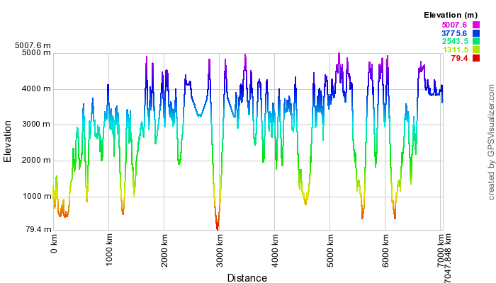
My final route through Peru looked like this…
[gigya type=”application/x-shockwave-flash” src=”http://www.everytrail.com/swf/widget.swf” quality=”high” width=”400″ height=”300″ FlashVars=”units=english&mode=0&key=ABQIAAAA_7wvFEi7gGngCZrOfos63hSN1xyBy-BzBD–25ZLXpVi3GfbehTQlZCXdpUFII2A5CGeExVTCyX1ow&tripId=1236552&startLat=-4.978570612&startLon=-79.116193866&mapType=Hybrid&” play=”true” quality=”high” pluginspage=”http://www.adobe.com/go/getflashplayer”]
PHOTO GALLERY -click the Smugmug logo
![]()
Awesome update. Thanks for letting us come with you on your travels.
I’m taking notes here Adam! Amazing rides, I may just have to leave my bike down South another Northern Hemisphere summer in Uraguay to give Peru the attention it needs.
John Martin Throttlemeister
Fantastic mate, loving the journey.
Doug
Fantastic reading and pics Adam. Do you find that the sky is some kind of special blue up in the Andes. Some days I’m sure it looked purple. Keep it coming mate.
Good to hear from you Brian. I emailed you recently but I guess I used the wrong address?
You’re right about the sky. It seems to get bluer the closer you get to the Tropic of Capricorn. I noticed it in Australia too. It was once suggested to me that it is to do with the angle the sun strikes the earth at those latitudes. In the Andes though maybe its because you’re above the pollution?
Hope you’re well…HI to Fie & Vincent!
Hi Adam, once again a truly awesome read. When you finally come to an end and put all this into a book I’m sure it will become an overlanders bible. Good luck my friend, I can’t wait untill the next installment.
Hi Adam great to read the Peru instalment and look forward to others. They’re quite enlightening as most describe countries we’ll probably never visit personally!
looks like you are having a great time mate, will get ther one day but not on the valk!!
Cheers Norm! Reckon the Valk would be doing a bit of belly dragging!
OMG
Brill
Awesome ride, story and Pics.
I”m truly enjoing your trip.
Best of luck
Hi Carlos,
Glad to hear you’re enjoying the ‘ride’. Good to have you onboard!
Cheers
Adam
Well done Adam, another masterpiece. Dave Gumn
Thanks Dave…still pedalling?
Hi Adam,
very much enjoying your trip.
Shame tents aren’t made a bit more camo shades.
Desert camo on one side and Autumn shades on the other.I’ve got an Aztec Duro,in bloody orange!Well it was,until I got a pot of Eddings marker pen Green…..
keep on keeping on,and thanks again,
Lorenz
BURBIDGE HERE
wooooooooooooooooooooh
Andover nothing changes, in the Andes myself last year, and just crossed east-west USA, so doing my bit.
Returning is difficult as I want to carry on as you have/are.
Best wishes, always thinking of you
Steve
Bakes
Mr Burbidge!!!
Good to hear from you Bakes and to know you’re ‘gettin’ er duuun!!!’
Reckon you’re right about Andover…that’s gonna be tough!
Great read and great pictures too.
Looks like you have had a good time after Arequipe.
I am sat at work getting more and more jealous the more I read.
Keep on living the dream
Sam
Adam
Thanks for update. I’m @ home recuperating from a bad cage accident. (Two broken legs). Ur blog helps. I hope to be riding in the Spring of ’12.
Keep the great RR’s coming, stay safe.
Rhino
Did you really say cage accident? Damn…
Good luck with your recovery…I’ll try to pull my finger out and have you some fresh reading material before Christmas.
Adan
Yes cage (us Yanks moto term for car).
Just started walking again, w/ a walker & a cam boot for left leg. Mostly still in wheelchair, but getting better. As long as I can still ride…
Selling my much beloved & modified ’02 Honda VTR1000 (U Brits know it as a Firestorm – us Yanks as a Superhawk). Going to buy a more 2 up friendly moto, looking at the new Suzuki V-Strom Adventure.
Feliz Anno
All the Best in 2012
Rhino
Woah! I’m really digging the template/theme of this website. It’s simple, yet effective.
A lot of times it’s hard to get that “perfect balance” between superb usability and visual appearance. I must say that you’ve
done a very good job with this. Additionally, the blog loads very quick for me on Opera.
Exceptional Blog!